Student Activity
Cold War Europe
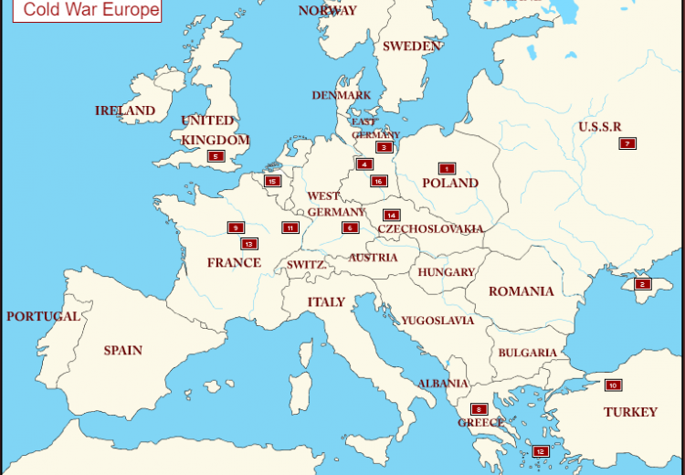
Photo caption
Interactive map of Europe during the Cold War.
Cold War Europe is an interactive map highlighting important events in the history of the early Cold War (1945-1949). It is used in the EDSITEment curriculum The Origins of the Cold War, 1945-1949 (grades 9-12).
Additional primary sources and guiding questions can be found below.
Primary Sources
- A Visual Guide to the Cold War (UNC Chapel Hill): A collection of photographs, political cartoons, posters, and movies from the United States and Soviet Union.
- The Red Scare (Smithsonian Learning Lab): A collection of sources, including documents, images, and secondary sources, about McCarthyism and anti-Communist fear in the United States.
- The Race to Space (Smithsonian Learning Lab/Heinz History Center): A collection of primary sources about U.S.-U.S.S.R. competition for dominance in space.
Guiding Questions
- Where did the name "cold war" originate? Is it accurate?
- Though this map centers Europe, the Cold War was a truly global conflict. Why was this the case?
- Select another region that was affected by the Cold War and create your own annotated map showing key conflicts and events. You may find these resources from History Blueprint helpful as you select a region and begin your research.